“I can now much easier see all the risks, and help me find a good farm.” — Bruce, VIC Farmer
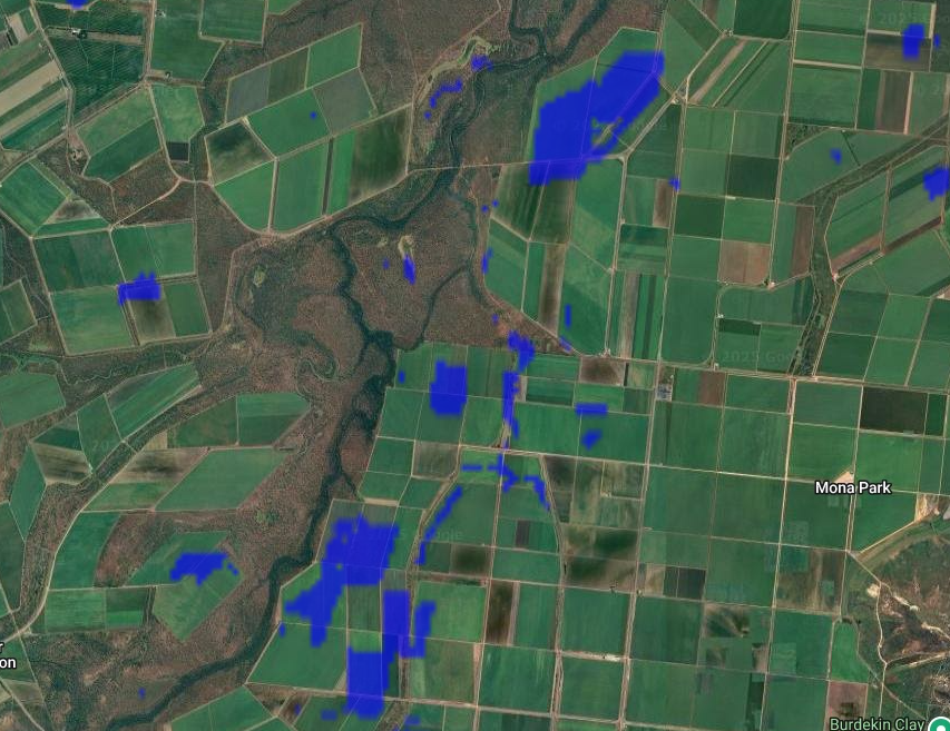
Natural Disaster
Near real-time monitoring of floods, fires, drought, and more. Stay ahead as weather becomes more volatile and set alerts for events that impact your farm areas.
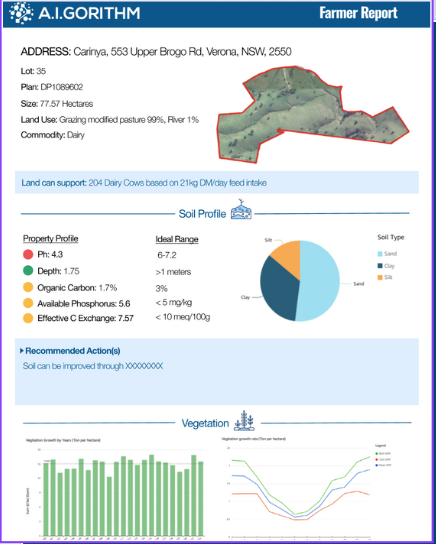
Property Profile
In-depth performance and risk insights across 45 years of data—from soil and climate to natural disasters— to support purchase or operational decisions.
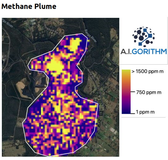
Environment, Social & Governance
Track deforestation, climate risk, and emissions. Use calculated emissions to measure and report ESG progress accurately.